
2 minute read
Advertisement
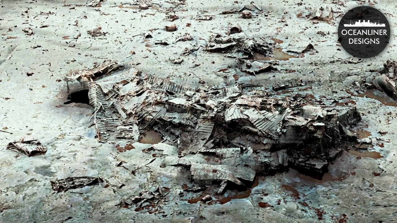
Magellan Limited is releasing its latest haunting 3D photogrammetry scan of Titanic's debris field. Oceanliner Designs' Mike Brady gives a guided tour of what the latest images reveal.
The Titanic continues to exert a fascination over people. I live just outside Belfast, and regularly see the many coachloads of tourists headed to the excellent Titanic Belfast museum. The fact that many of them nowadays arrive on cruise ships docked in Belfast Lough is an irony that never gets old.
Given everything that's happened recently, especially the OceanGate Titan submersible tragedy almost three years ago, it's hard to remember that there were so many decades when we didn't know precisely where the wreck of Titanic was. Robert Ballard found her in 1985, and one of the first things his team saw on the seafloor was an immediately recognizable boiler that helped confirm what they found.
Now forty years on, Magellan Limited has documented the wreck site in enough detail that you can virtually fly around that same boiler, measure the crater formed by its impact on the seabed, and see the rust pooling around its base in real time.
"The boilers landed like meteors, like comets, smashing straight into the seafloor. So they basically mark where Titanic broke apart on the surface," says Mike Brady of Oceanliner Designs in his guided tour of Magellan's 3D scan of the debris field surrounding Titanic's stern section. This is the latest release in the company's ongoing project to document the entire wreck site and it's a fascinating watch.
Magellan uses photogrammetry to scan the wreck. An ROV, roughly the size of a small SUV, makes systematic passes over the site, photographing as it goes. 715,000 still images and 16 TB of 4K footage have been stitched computationally into a navigable 3D model. The company has already released the bow and stern sections via its vROV Pilot app on Steam, but the newly completed debris field scan, covering the chaotic zone between the two main hull sections, is the most technically demanding release yet.
The 3D model is now detailed enough to identify individual components: a lifeboat davit still cranked out to its launch position, the ship's direct contact heater still partially connected to its fixtures, and a teak-tipped section of one of the masts.
The debris field will be added to vROV Pilot shortly. Magellan has received an Emmy nomination for vROV Pilot and has since moved onto to its next project, a full photogrammatic capture of the famous wreck of the German battleship Bismarck, which lies nearly a kilometre deeper than Titanic
"This is so forensic. You could just sit here and watch it all day. It's absolutely remarkable," says Brady, and he's not wrong.

Written by Andy Stout
Advertisement
Advertisement
Advertisement
Advertisement
Advertisement
RedShark is a multiplatform online publication for anyone with an interest in moving image technology and craft. With over 50 contributors worldwide, full-time developers, editorial, sales and marketing staff, it is the go-to site for informed opinion and know-how for the quickly changing video, film and content creation industries.

RedShark 2020 @ All rights reserved.

Comments